GEOTECH is a business company established in 1994 in Bratislava, Slovakia and since then they are local distributor and service center of Leica Geosystems. The company resells the products of several brands for many different applications. Most of the staff are educated surveying engineers, and the surveyors consist a major part of customers but they focus also on the construction, GIS, forestry, agriculture, environment and other areas of using various instruments for measurements.
Interview with Erik Frohmann, CTO at GEOTECH.
Easy Engineering: What are the main areas of activity of the company?
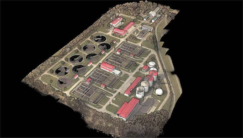
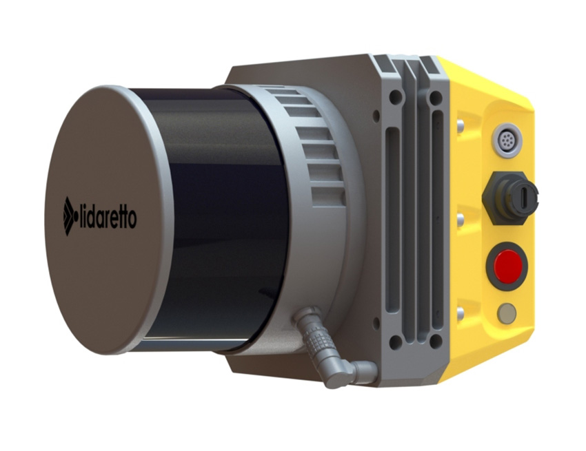
Erik Frohmann: Because we know well what our customers need, and we follow the technological progress we have realized that LiDAR technologies will become very important tool for efficient 3D data capturing. In 2014 we have started to develop our own LiDAR mapping system with the aim to produce compact, lightweight, multiplatform, and cost-effective solution easy to use for anybody even without surveying experiences. The result of our development is LIDARETTO.
E.E: What’s the news about new products?
E.F: Within Lidaretto we integrate LiDAR modules from different manufacturers. Latest we have built new models integrating LiDAR modules from Hesai company which provides high quality data which important for further producing low noise point clouds. We integrate also high-performance Lidar CL360 from Teledyne Optech generating highly accurate and dense point cloud for most demanding applications. Our main software product is Lidaretto Creator where we add continuously new functions and improvements in order to provide the users with highest quality point clouds easiest way.
E.E: What are the ranges of products?
E.F: Currently we offer Lidaretto integrating Lidar modules from Hesai, Velodyne, and Teledyne Optech. Each model can be offered in several variants depending on the customer’s requirements. We offer also different peripherals to our Lidaretto models like cameras, DMI, etc.
E.E: At what stage is the market where you are currently active?
E.F: LiDAR scanning is very powerful and very efficient mapping technology, and its potential is huge for lot of different applications. But the conditions in the field are different for every job, and the user has to decide what approach will be the right one. Therefore, it is very beneficial for the user to have one tool allowing him to be flexible, and decide even on the site if to put LiDAR on the drone, on the car or carry it on the backpack to do his job. This flexibility and multiplatform use were our primarily goal when we develop LIDARETTO. Another big benefit is that the user will invest only once and save the money they would have to spend if buying multiple LiDAR systems for specific application.
E.E: What can you tell us about market trends?
E.F: We see increasing demand for Lidar based mobile mapping systems that allows to increase the productivity for the users. Our customers appreciate that with Lidaretto they can get single unit capable to be mounted on several platforms like UAV, car, backpack, boat or even train. This multiplatform approach is very important as it saves user’s budget, and speed us his ROI.
E.E: What are the most innovative products marketed?
E.F: We still improve our Lidaretto system and look for the innovations that the progress in technologies brings. We try to understand what our customers expect, and then we build it within Lidaretto solution.

E.E: What estimations do you have for 2023?
E.F: As our potential customers get more knowledges and experiences with the capabilities of Lidar based mobile mappings systems, I expect increased demand for our products. We work hardly on new functionalities to become one of the technology leaders.