KOREC Group is the UK Trimble distributor for measurement solutions, surveying equipment & mapping systems to empower you to measure, map and manage the natural and built environment.
Interview with John Cartledge, Mapping & GIS Business Area Manager at KOREC Group.
Easy Engineering: A brief description of the company and its activities.
John Cartledge: We provide geospatial equipment for hire and sale, combined with the best software transforming your outcomes by bringing speed and certainty to your work. Our mission is to empower your business through harnessing world-leading, geospatial technologies from our global partners, combine the skills, knowledge, and unrivalled expertise of our regional specialists, to deliver the results that transform your business outcomes.
E.E: What are the main areas of activity of the company?
J.C: The KOREC Mapping and GIS Division focus on providing end to end solutions delivering cost effective, centimetre accurate GNSS, data processing and mapping software as well as UAVs to many customers in a diverse range of sectors and applications, but our primary customers are utilities, road and rail companies and their contractors for asset management and maintenance works, drone survey companies and land/estate managers including mines and quarries.
E.E: What are the ranges of products?
J.C: With over 30+ years of specialised surveying and mapping expertise, we’ve learned exactly how surveying needs can vary by industry. Whether you’re surveying unpredictable marine environments or vast rail networks, every industry faces its own challenges.
This is why we offer tailored solutions and support across a range of industries. We can help you find workable and dedicated surveying solutions to tackle a whole host of highly specialised projects within your niche – from civil engineering, rail and highways, to BIM and utilities. We have literally worked our way through the alphabet from Archaeology to Zoology delivering solutions that meet our customers need.
E.E: What can you tell us about market trends?
J.C: Serving such a wide variety of markets and applications, KOREC Mapping sees market demand rise and fall at different rates and times, for different reasons. The decline in activity due to Covid has passed with the surveying and construction markets currently refreshing hardware and software to meet the demand for development, this is both in the buy and hire space. The main drivers at present are a much keener focus on price and out of the box functionality, and this is where we excel in our portfolios.
E.E: What are the most innovative products marketed?
J.C: Field data collection hardware – 40 years of Trimble innovation
If we start with the GNSS receivers the mapping team provide, these include the lightweight Trimble DA2 Catalyst Solution, a revolutionary GNSS concept that simplifies the way precise GNSS positioning is delivered though offering a low-cost survey grade receiver with 1cm, 10cm, 30cm or 60cm RTK corrections on very flexible use models. These include annual unlimited, monthly or pay as you go subscriptions to meet the needs of every user, large or small.
We also provide the military grade, cable free, IP65 rated Trimble R580 for everyday high accuracy survey and GIS applications. The R580 includes the Trimble ProPoint positioning engine to ensure you still have positional accuracy in challenging environments like under trees plus xFill correction technology to ensure you are never not connected. The unit also incorporates CenterPoint RTX corrections via satellite/IP in addition to using the Maxwell 7 technology with anti-spoofing capabilities, and Trimble EVEREST Plus multipath signal rejection. An incredible compact unit with unbeatable features at a reasonable price.
So, choosing your receiver is just the start point for a customer’s journey with us, next they need a data logger. The DA2 can connect to any Android or iOS Bluetooth enable device and chosen application, but they need an all-weather, ruggedised unit and we recommend the TDC6 a powerful, cost effective Android field data collection unit. It supports Trimble Access, TerraFlex, Esri ArcGIS Field Maps and the range of K-Capture and K-Portal solutions from K-MATIC, or any other field collection software of the customer’s choice.
The TDC6 has been specifically designed for the job with upgradable Android 12 OS, 5G cellular connectivity and weighing in at just 287g/10oz is ideal for a full days work in the field. One distinctive feature is that the batteries are hot swappable for those long days, and with Wi-Fi And 5G onboard you are connected and can move your data between field and office quickly, easily and securely.
Field data collection software – customisable all the way
So, getting back to software, the KOREC Mapping team have a range of options to suite the need of any client. These include Trimble Terraflex – an easy to use field data capture application allowing customized form templates, synced to the back office, with data visualisation and export capability so the customers organisation get maximum value from the data quickly.
K-Capture and K-Portal software have been designed and developed over many years in conjunction with our customers to specifically meet their needs for a fully customisable data collection, hosting and serving tool. With modules for Utilities, Highways, Drones/UAV’s, Canopy and Fibre and Gully applications it’s a great partnership with both the receivers above and the data collection device of your choice.
Drone technology – fixed wing or rotary solutions
We’re observing a significant rise in the demand for drones/UAVs, driven by their essential integration into everyday operations. This increase is fuelled by confidence in the reliability of the data they collect and their efficiency in capturing it swiftly and effortlessly.
KOREC has been servicing the survey market with drones for many years with handpicked models that deliver great results. The current portfolio includes the Parrot Anafi AI 4G robotic UAV – a great all-rounder with 4G connectivity, autonomous photogrammetry designed for large scale mapping jobs and a 48MP camera to capture that all important detail whether it be creating ortho’s or inspectionsa great all-rounder.
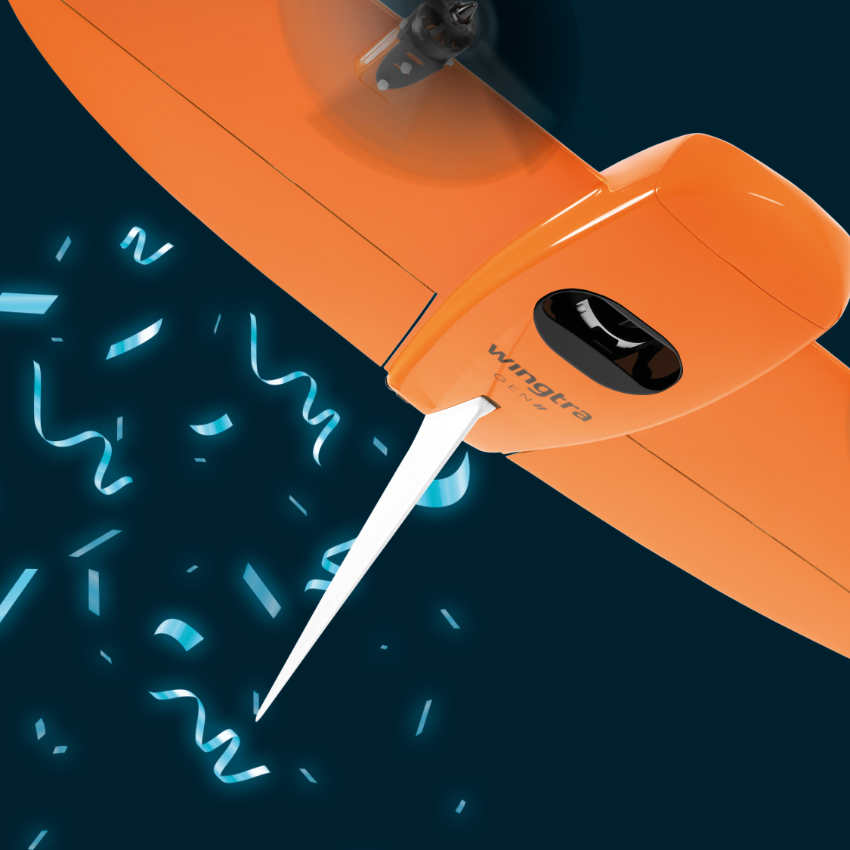
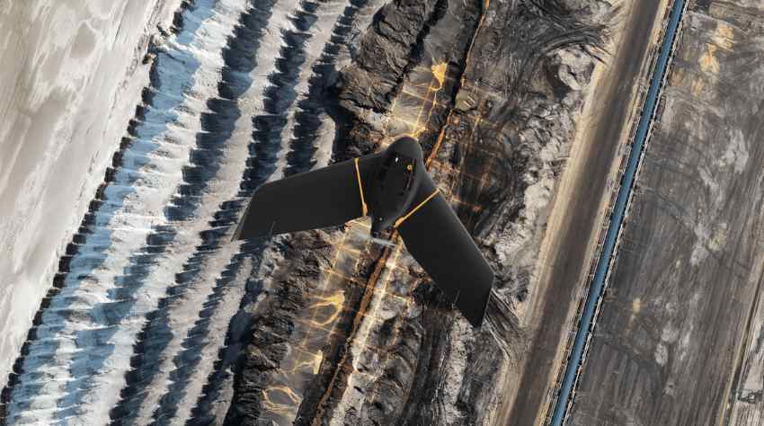
We also supply fixed wing units in the shape of the AgEagle eBee X mapping drone with various payloads to meet the requirements of any job. The newest unit is the WingtraOne GENII an amazing VTOL (vertical take-off and landing) drone has a long flight time and the additional benefit of a superb LIDAR payload ideal for larger area and corridor mapping of land estates, mines, quarries, construction sites and railways where that extra level op detail is all important.
So, in conclusion, with a range of receivers, drones/UAV’s, data collectors and software available, KOREC Mapping delivers real end to end solutions based on customer need and at a price to meet all budgets. Give us a call and experience the KOREC difference knowing you can T.R.U.S.T. KOREC:
- Transparent – Always open and honest
- Reliable – Always dependable and consistent
- Understanding – Always understands the customers’ needs and wants
- Supportive – Always on hand to help and support
- Timely – Always deliver results and solutions in a timely and efficient manner
E.E: What estimations do you have for 2023?
J.C: 2024 has seen some market uncertainty with various large construction projects being either scaled back or cancelled altogether, but this has driven funding in new areas like highways maintenance. The ever increasing demand for higher precision and detail required for asset management is also driving a need for better, more reliable solutions that automate many processes saving time and cost.
It would be remiss of me not to touch on the implementation and adoption of AI in many areas of data processing and operational processes, this will only increase, but working with trusted solutions that are field tested can only make our everyday lives more productive.